After our trip to Telluride, I was playing around with google earth. The program allows for virtual tours of the earth. It really is like a flight simulator, albeit in a plane with orbital capabilities. Nice!
It is an amazing tool, and as far as I can tell, only final fine tuning
changes remain. The original version had problems crashing, etc. Those
bugs are gone. Now, the program optimization is down to adding the
"nice things." For example, it would be cool to integrate
Google Earth and Google Street View. That would be like a "Superman"
view, enabling a "giant leap" into flight. Watch for Google to
integrate the two. They seem to really be able to deliver more than
expected. Another very nice feature would be
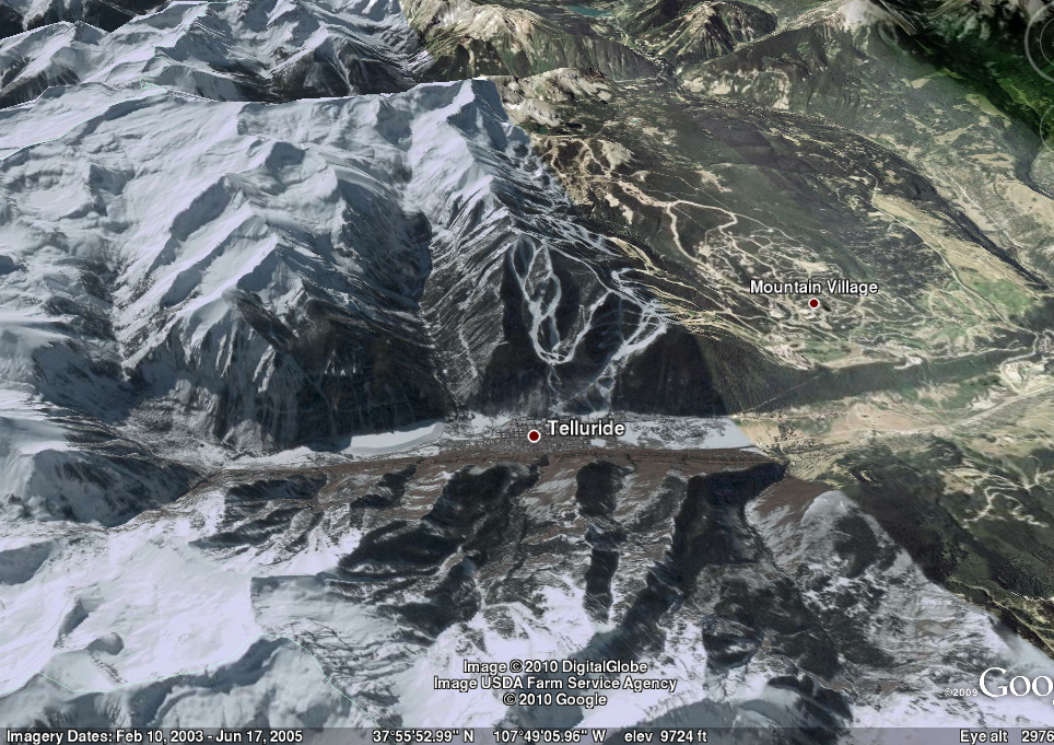
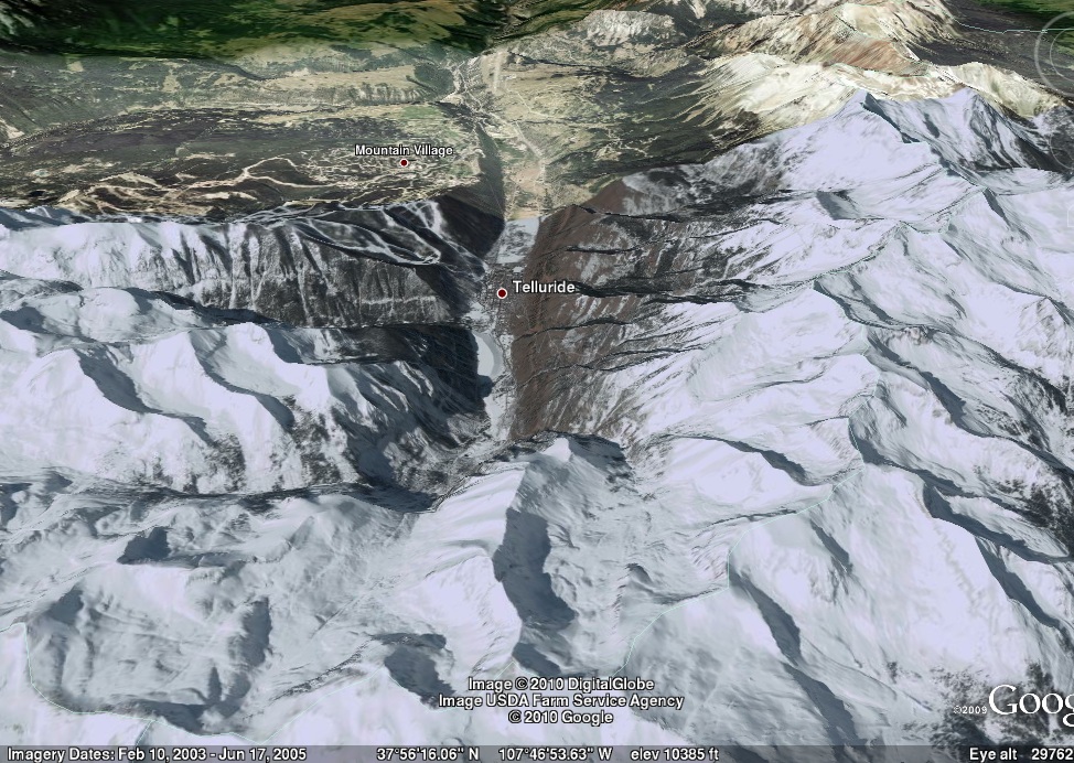
to correct the imagery database for time of year, perhaps a
spring-summer-fall-winter slider bar. The snapshots below show a winter
view, but
with a straight line of discontinuity where more snow has melted in the
early summer. Otherwise, very cool!
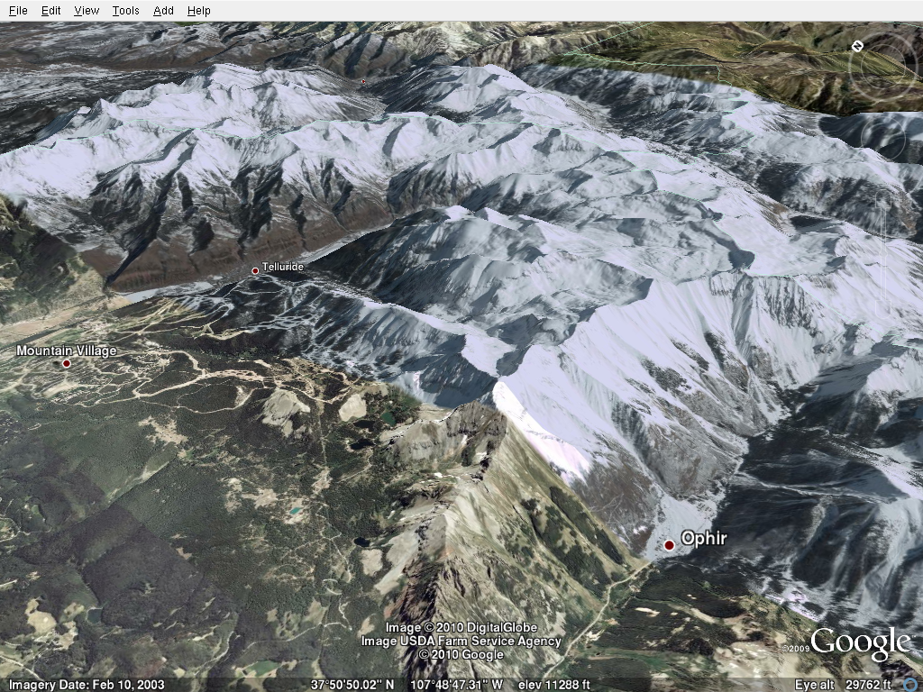
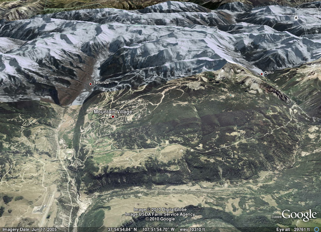
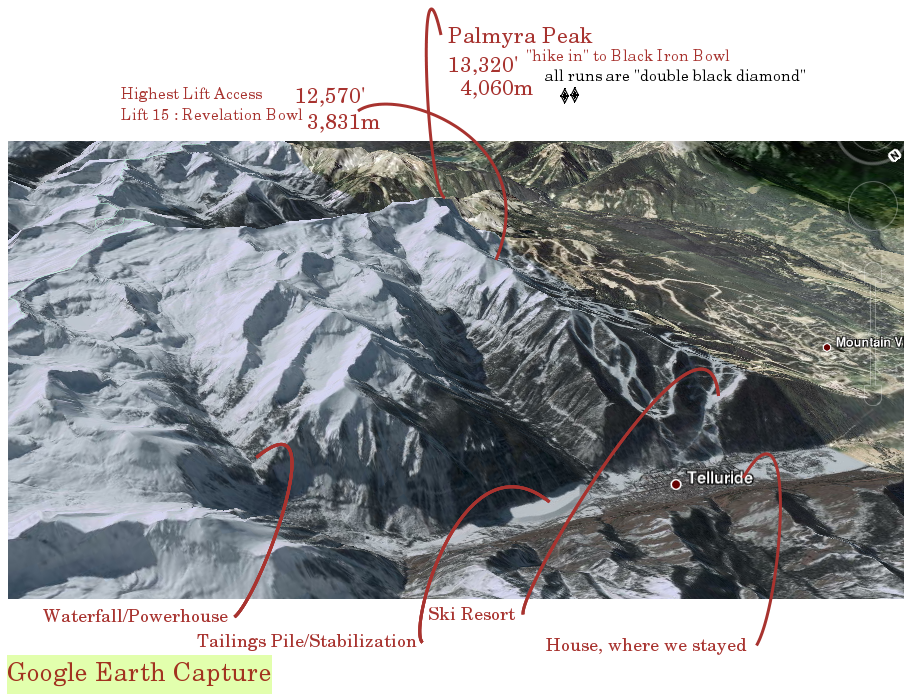
Google Earth is really a powerful tool, beyond the "toy" stage. It
is a user-interactive 3D tool that can be used to understand local
geography. One immediate use is to present a view of a "virtual" ski
resort. This view would supplement the resort trail map. Large resorts
like Telluride have many lifts which cover complex terrain. The flat
trail map doesn't adequately describe all areas. A 3D tool is
necessary. You can see some of its abilities in the following screen
captures that are taken at roughly right angles from eath other; literally,
they are the view from 30,000 ft. I used it to understand the location
of various features in the box canyon: the town, the ski resort, the
tailings pile, the waterfall, etc.
 google earth
 google earth
 google earth
 google earth
 google earth