KUTV's New Animated
Weather Map
Sorry, I can't make MPEGs yet. This is a lower-resolution version of the
clip that plays several times a day on our local TV.
 Still frames:
Click a thumbnail for
a full-size (640X480) image.
The weather guys use this 14-second animation to display their forecast
for the Western US AND the Wasatch Front in Utah. This
is the most detailed 3D weather map I've seen, and I've seen quite a few
of them!
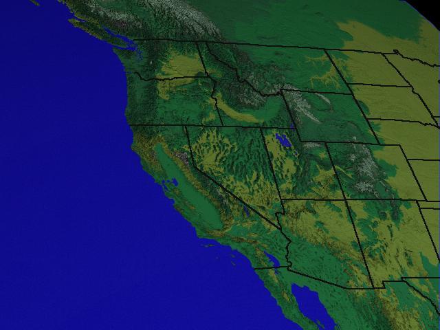
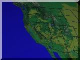
- Frame 1: This shot is identical to the view from the GOES-9
satellite. It is the background for the satellite cloud view that you
see in almost every weather report. By matching the satellite view, we
can fly right into the scene. As far as I know, KUTV is the
only station in the world with this ability.
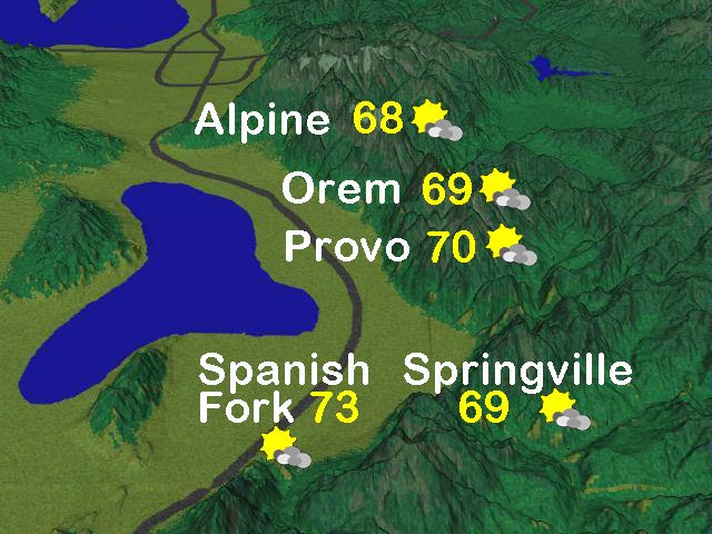
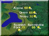
- Frame 2: Wow, a lot happens between the first frame and this one.
While looking at Utah, we fly a fairly straight path till we're low over
the Mexico/Arizona border, then fly straight north to this point looking
down on Utah Valley, about 50 miles south of Salt Lake City. The Great
Salt Lake is visible in the upper left corner.
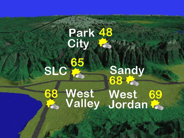
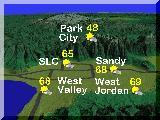
- Frame 3: We swing to the west and north, parking over the Oquirrh
Mountains west of the Salt Lake Valley. We see the cities of the SLC
metropolitan area.
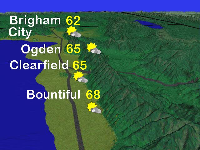
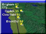
- Frame 4: We swing east over the Salt Lake Valley to look along the
northern Wasatch Front, viewing the cities of Bountiful, Centerville and
Ogden.
Copyright ©1998 Lynn Wallace
 to previous page.
 |
 to my home page
 |